Thursday, 27 November 2014

August long weekend at Nimpkish lake


On the August long weekend I packed up my gear and drove home to Northern Vancouver island, my plan was to explore the length of Nimpkish lake and photograph the Pictographs up and down both sides of the lake. Nimpkish is situated south of Port McNeill  and runs parallel to hwy 19 the lake is about 22 km long and has a nice campsite on the southern end of the lake only five minutes from the highway. I have had a love affair with this place since the 80s when a few good friends and my wife and I discovered the windsurfing potential of this lake. It is now a popular destination for kite and board sailors, from May to August, if you decide to go paddleing here do it early in the morning before the thermal winds starts up from the north.

I arrived at the campsite around noon on  Friday the wind was already blowing around 25 to 30 knots and the sailors where out having a great time. It seemed like the perfect opportunity to try out my new/used boat ( a Nimbus Telkwa) in some rough water, I paddled up wind to the point just bearably making headway strait into the wind and 3 foot waves I turned the boat  around and was soon catching nice little rides on the  waves as I headed back along the shore line. I was more then happy with how well the boat handled it gave me a big boost of confidence compared to my last kayak.

the adventure begins 
Saturday  5am I rolled out of my sleeping bag made a coffee and started my adventure it was a typical Nimpkish morning with calm conditions.


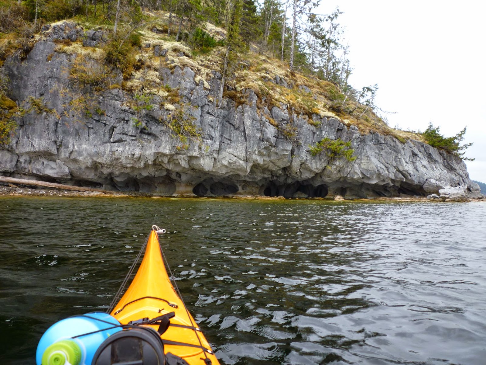
One of the first things that will strike you as you start paddling up the lake is the weathered limestone rock formations along its shores. The North island has it’s fare share of limestone caves  such as Little Houston caves not far from Nimpkish and a great side trip for windy days  you can  literally swim right threw a mountain side,  just ask one of the Nimpkish sailors for directions, or check out the web site http://www.vancouverislandnorth.ca/things-to-do/nature/parks/little-huson-park/

First limestone rock formations on the East side of the lake

As I headed up the east side of the lake I kept an eye out for first nation Pictographs on any of the rock faces along the lake and  I was soon rewarded after about an hours paddle.  Nimpkish was not only an important food source for the Kwakwaka’wakw  speaking peoples it was also part of trade route that cut across  the island to the west coast, it was probably much safer and faster than going around Cape Scott. And judging by the amount of paintings it was a busy place.

unfortunately this rock face has been defaced in the more recent past   

this figure had a potlatch hat 
As I keep heading north I came to midway island a good place to have a stretch and watch the seals, yes the lake has a permanent population of fresh water seals and they use the island as a save place to hang out.

exploring some of the woods along the way 

one of the many little creeks along the way

I love the texture of this limestone boulder 
After having some lunch I headed up the lake checking out a few beaches on my way  I then decided to paddled across to the west side of the lake and pick out a nice beach to spend the night just as the wind started up.

There is no shortage of good camping beaches I found this one on the west side 
Sunday 7 am, after a relaxing morning I packed up camp and headed north the morning was calm and I took photos of more  Pictographs along the way.

I could only make out one face in this bunch pictographs

These one where quite elaborate with a copper on the top and some sort of animal figures on the bottom

the old telegraph line in front of these much older pictographs

 By about 11:00 am I had reach the end of the lake so I had a leisurely lunch break and went for a walk. At around 1:00 pm I started paddling south just as the wind started to kick in from behind.  I saw a few more  Pictographs on my way back down the lake and checked out a couple of nice beaches the wind was blowing 15 to 20 knots giving me a nice push back down the lake

logging bridge at the north end of the lake, don't go past here unless you have a white water kayak

Heading back to the south end of the lake

A copper and a man in a dugout with what looks like two broken coppers 

one of my favourites was this sun with a copper on each side and a salmon figure 

you can find some really amazing shapes in the limestone 

A butt break...I mean a beach break 
  by 4:00 pm I was back under the shadow of pinder peak at the south end of the lake to spend another night at the windsurfers campsite before heading back to Victoria in the morning. A nice weekend trip. 

Pinder peak 


1 comment:

  1. Awesome photos Rob, never been up there but I'd love to go. Thanks for sharing.

    ReplyDelete